


26 August 2026 Nepal-Tibet Border Flash Flood
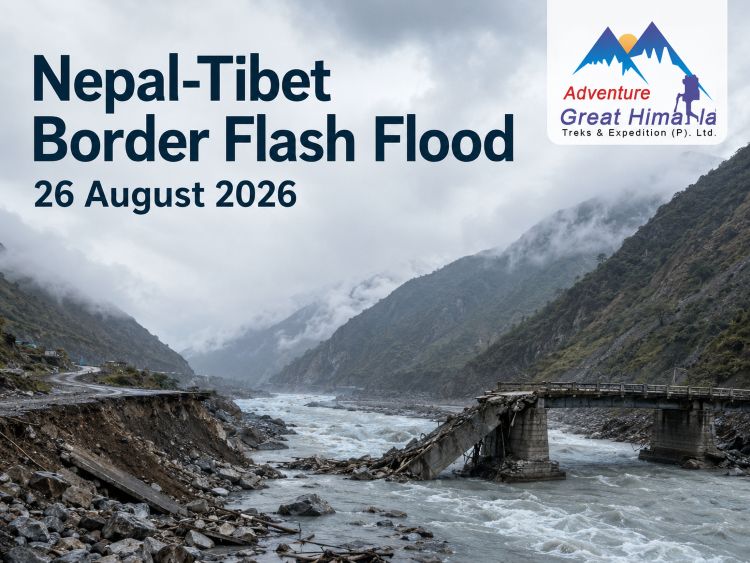
On 26 August 2026, a catastrophic flash flood struck the Bhote Koshi River corridor along Nepal’s northern border with Tibet, China, causing extensive destruction in Rasuwa District and downstream areas. The flood swept through communities, roads, bridges, border installations and hydroelectric projects, triggering a massive search and rescue operation.
In Nepal, the worst-affected regions were the sections of Rasuwa District near Timure and Syabrubesi. Floodwaters and debris subsequently affected downstream sections of the Bhote Koshi and Trishuli river systems.
What Actually Happened on 26 August?
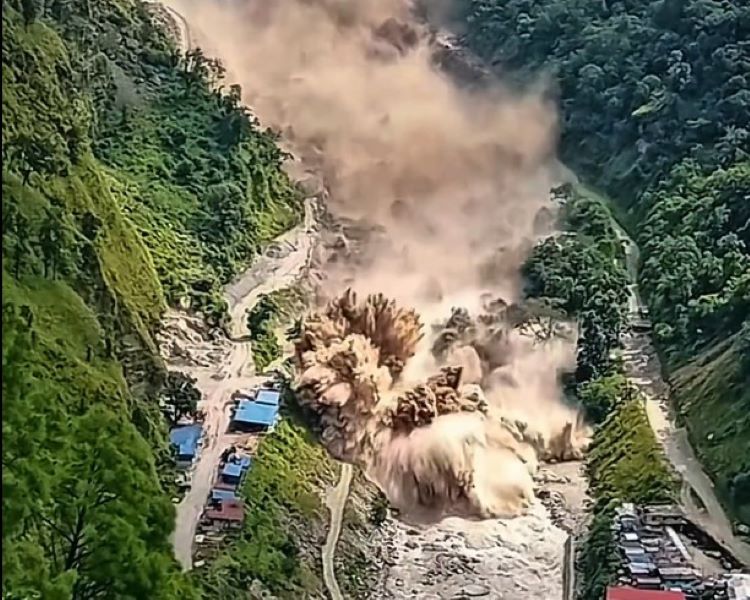
The flood in the high Himalayan border area developed very quickly. Early reports said that the water surge and debris entered the Bhote Koshi River Basin suddenly, leaving very little warning time for the local population and travelers who were there at the time.
Initially, reports were quite vague regarding the cause of the event. Recent assessments indicate that it could have been an ice or rock avalanche triggered by glacial activity in the Tibetan region, resulting in a significant downstream surge. Nevertheless, the exact process and the extent to which different factors, including glacier instability, played a role are still under investigation.
The flood then swept through the narrow Himalayan river corridor with destructive force, causing damage to buildings, roads, bridges and other infrastructure. Automatic monitoring facilities installed in the upper part of the Bhote Koshi River were also destroyed, complicating subsequent monitoring.
Which Areas Were Affected?
The primary disaster-hit region in Nepal was Rasuwa District, particularly the Bhote Koshi valley near the northern border.
Reports identified severe impacts around areas including:
- Timure
- Syabrubesi
- Rasuwagadhi
- Pairebesi
- Mailung
- Betrawati
- Trishuli and other downstream areas
The effects extended beyond the immediate border area because the Bhote Koshi feeds into the wider Trishuli river system. Authorities therefore issued warnings to communities farther downstream as river levels rose and conditions remained unstable.
This disaster also adversely affected cross-border travel for laborers, businesspeople, tourists, pilgrims and others making their way to Tibet.
Casualties and People Out of Contact
The full loss of human life is yet to be determined, as rescue efforts are ongoing.
According to reports from Nepali authorities and the local press on 26 August, 22 deaths had been confirmed, while 384 individuals remained out of contact. Some of them were foreigners and members of the security forces. The Kathmandu Post added that 88 individuals had been rescued by helicopter by then.
During a disaster in which roads are damaged, communication infrastructure has been destroyed, people have been relocated and rescue operations are ongoing, the number of people out of contact may vary greatly.
Subsequent reports revealed that the scope of the disaster was far greater than initially reported on 26 August. The number of casualties and people unaccounted for continued to rise as rescue teams reached previously inaccessible areas.
The number of confirmed deaths caused by the devastating flash floods has now risen to 903, while 4,247 people remain unaccounted for as search and rescue operations continue.
Rescue Operations
Nepal mobilized the Nepal Army, Nepal Police and Armed Police Force, along with helicopter services and other emergency responders.
Rescue efforts were complicated by many factors:
- Damaged roads and bridges
- Bad weather conditions
- Communication breakdowns
- Difficult Himalayan terrain
- Persistent river dangers
- Damage to infrastructure used to access remote areas
Helicopters were especially critical for reaching individuals stranded in areas where roads had been washed away or obstructed. On 26 August, dozens of people were airlifted from the affected areas.
Coordination across the Nepal-China border was also necessary because the incident affected areas on both sides of the Himalayan border.
What Does This Mean for Travelers?
The recent flood catastrophe does not mean that the entire country is unsafe for travelers or that all trekking areas have been affected.
Nepal is geographically diverse. The area most severely affected by this natural calamity is the Rasuwa, Bhote Koshi and Trishuli belt.
If you plan to travel through northern Nepal, you should take this situation very seriously.
If your destination involves traveling through Rasuwa, Langtang, the Nepal-Tibet border or nearby river corridors, do not depend only on your pre-booked itinerary, hotel reservations or information available before the disaster.
What About the Langtang Trek?
The Langtang Trek needs special consideration because the region is in Rasuwa District and is connected to transport and infrastructure networks that have been adversely affected by the flood.
This does not mean that every part of the Langtang trekking area has been completely destroyed or that the region is permanently closed to trekkers.
Travelers need to consider current route and access conditions before planning their trip.
You should reconsider your Langtang trekking plans if:
- The approach road is affected
- Bridges or river crossings are unsafe
- Authorities have introduced travel restrictions
- Weather conditions could trigger further landslides or floods
What About Everest, Annapurna and Manaslu?
The Rasuwa and Bhote Koshi event does not necessarily mean trekking routes across Nepal are closed.
Trekking destinations like Everest and Khumbu, Annapurna, Manaslu, Mardi Himal, Ghorepani-Poon Hill and Upper Mustang are geographically distant from the area affected by the floods.
Still, August falls within Nepal’s monsoon season. Rain can trigger landslides, road closures, river flooding and other transportation disruptions in other parts of Nepal. Therefore, checking current local conditions immediately before departure remains essential.
What Should Travelers Do Now?
If you plan to travel to Nepal during this period, keep the following precautionary measures in mind:
- Check current road, trail and weather conditions before leaving.
- Verify that access is possible through a trustworthy trekking agency or guide.
- Do not enter the disaster-hit area until authorities confirm that it is safe.
- Do not go near rivers, bridges or recently damaged roads.
- Do not attempt unofficial river crossings or travel through closed roads.
- Add extra contingency days to your plan.
- Keep your phone and other communication devices fully charged.
- Have offline maps available, as mobile services may be unreliable.
- Keep your travel insurance details and emergency contacts readily available.
- Prepare to change your trekking route or cancel the trip if conditions worsen.
Those who are already in the disaster-affected area should follow the directions of local authorities and security personnel.
Responsible Travel After the Disaster
The first concern in Rasuwa should be ensuring the safety and rescue of those affected in the region, including residents, workers, rescuers and families looking for missing relatives.
Tourists are advised not to visit disaster-hit areas for sightseeing, photography or social media content. Roads and bridges that appear safe might not actually be stable. River conditions may also change and become dangerous without warning.
After the affected regions are declared safe by the relevant authorities, responsible tourism will go a long way toward supporting local livelihoods. Guides, tour operators, drivers, lodge managers, restaurant operators and other small businesses depend on tourism.
The Message for Himalayan Travelers
The Rasuwa flooding incident clearly highlights why Himalayan travel cannot be determined simply by whether a destination is open or closed.
The risks of traveling in the Himalayas are highly localized. A disaster in Rasuwa does not necessarily mean that similar conditions exist in Everest or Annapurna.
On the other hand, the absence of a disaster in a trekking region does not mean that its routes are automatically safe during monsoon conditions.
Therefore, travelers must consider three things separately:
- The destination: Is the trekking region itself safe?
- The route: Is the access route to the region safe?
- The conditions: Are the weather, roads, rivers and bridges stable enough for the journey?
This approach will make the decision-making process before beginning your trip much easier.
Speak to our local travel expert, who can assist you in planning your trip.
PLAN YOUR TRIP Friday, September 18th, 2026
Top 10 Best Trekking Operators in Kathmandu, Nepal
 Friday, September 18th, 2026
17+ Best Things to Do in Kathmandu, Nepal
 Sunday, September 6th, 2026
Annapurna Base Camp Trek from Pokhara
 Wednesday, September 2nd, 2026
Best Everest Three Pass Trek Company in Nepal
 Tuesday, September 1st, 2026
26 August 2026 Nepal-Tibet Border Flash Flood
 Tuesday, September 1st, 2026
How to Get to Everest Base Camp from Kathmandu?
 Monday, August 31st, 2026
Everest Base Camp Trek Permit, TIMS & Guide Requirements
 Thursday, May 7th, 2026
Manaslu Trek Routes Guide
 Thursday, June 11th, 2026
Is Nepal Safe for Tourists? Travel Safety Guide
 Thursday, June 11th, 2026
Spiritual Travel in Nepal: A Guide for Seekers
 Monday, April 27th, 2026
Manaslu Trek Booking with Tour Guide Vs Agency
 Tuesday, July 7th, 2026
Best Everest Three Pass Trek Company
 Saturday, July 11th, 2026
How Hard Is the Everest Three Passes Trekking
 Tuesday, August 11th, 2026